We had been waiting on the deserted jetty all morning when a little Sami man walked slowly by, bent in back and with a pointed grey beard. He told us he was a wizard and he and his wife – a witch of course – were the only year-round residents in the area. Perhaps he could conjure up a boatman who could take us across the lake. “No boat. You must go like this,” he said, and began to twirl his finger in circles above his head whilst making helicopter noises. But there were no helicopters either.

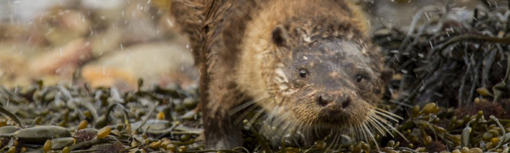
Ahhka
We were on the shore of Lake Ritsem, but we were on the wrong side. Across the water was Sarek National Park, known to many as “Europe’s Alaska” or the “Last Wilderness in Europe”. I had been to the fringes before but I had never crossed from one side of this trackless land of mountain and glacier to the other. It would take Tommy and I twelve days to cover the 100 miles. Everything we needed for those twelve days – shelter, food, clothing – was in the packs on our backs, and “everything” weighed thirty kilos each. But that was the least of our problems. We had to cross the lake first – seven miles of water and there was no boat – or helicopter.

Nijak
And then, a guy in a khaki cap came by. He had a Burt Lancaster moustache and shades. His name was Marcus. He was an elk hunter and, more importantly for us, he had a boat and was happy to take us across. The glaciers and ridges of Áhkká, the mountain that stands guardian to Sarek, loomed ever nearer until we were there in the mouth of the mighty Vuojatadno river. Marcus found a bank for us to jump onto. We handed rucksacks over and then, with one hand raised in goodbye, he spun round and was off. And we were there on the edge of Sarek, on the edge of wilderness.

Ruohtesvagge
The landscape of this part of northern Sweden, 100 miles north of the Arctic Circle, is much like the Highlands of Scotland that I call home. The mountains are borne of the same rock, the land has undergone the same glacial transformations and the flora and fauna bears similarities. But here everything is turned up a notch; the mountains are a little bigger, the corries still hold ice – remnants of the last glacial period, the vast birch forests are not fragmented as they are in Scotland and here they reach a natural treeline. The fauna is more complete; there are bears and lynx, although wolves have been persecuted to local extinction. There are no roads and only a handful of huts (kept locked for the Sami reindeer herders). The sense of isolation is profound.

Stuor skoarki and Rapaselet
Mountain
We had started the trek in the montane birch forest. As we rose higher the trees became more stunted; little bonsais, contorted and tortured by the wind. We had passed through the treeline. Now we crossed open land of lichen, blood-red bearberry and dwarf birch hugging the contours of the rocks; their crisp, tawny autumn leaves fidgeting in the northern wind. Here we made our second camp.

Bearberry and Rapa delta with Skierfe on the left
Nearby was a rare sign of human habitation, a kåta, a wigwam-like structure of wood and earth built by the indigenous Sami who, for generations, practised a form of transhumance, following the reindeer to their high summer pastures. They would build these shelters where the reindeer grazed.

Kisuriskåtan
Not far away we saw some, clearly man-made, depressions in the ground; thousands of years ago the Sami would hunt the reindeer by digging these trapping pits and herding the reindeer into them. There are over 3000 ancient cultural remains in Lapland; it may feel like an “untouched” wilderness but the Sami have been here a long time.

Reindeer bull
We saw reindeer almost every day but there is another mammal in Sarek that’s even more abundant. Lemmings. We stepped over their prostrate dead bodies many times. Great mats of lemming droppings filled bare patches of ground and their runs crisscrossed through the short grass. It was a boom year, when their population reaches a critical point until the inevitable: death en masse. The myth goes that they commit suicide, flinging themselves off cliffs, but the reality is that the population density is so high they are forced to migrate, succumbing to death by stress, starvation and drowning in mountain streams.
The only live lemming I saw was one evening at camp. I was brushing my teeth by a stream when a small furry, black and tan face appeared at a burrow on the bank, just an arm’s length from me. I stopped brushing and, without moving my head, turned my eyes to look. He just sat there as if admiring the view from his waterside burrow and then he squeaked, ran back in and I carried on brushing my teeth. I always get a thrill from close encounters. It doesn’t matter to me whether it’s a white-tailed eagle or a buck-toothed rodent.
Glacier
About seven days into the trek we were in the heart of Sarek. We set up camp where three valleys meet. For days we had been walking at the altitudinal limit of vegetation and now we headed higher, into a hanging corrie, a raw and lonely land of rock and snow, where the earth had been forced into the clouds by time and tectonics.

Tjågnåris – which I hope is pronounced ‘Chuck Norris’
We crossed a boulder field – two modern monkeys hopping from rock to rock – high on the mountainside. When we came to the gaping mouth of the Tjågnåris corrie we sat on the shoulder of the mountain and watched grey tendrils of cloud slipping around the black cliffs above us. In the distance was our destination: the snout of the glacier. We left the massive boulders and followed the flat plains of gravel moraine, threaded with milky streams flowing from the melting ice. And then the sense of wilderness was pricked ever so slightly. We found a rock with red paint daubed on it. Numbers: 1963. A little further was another, 1968, and another, 1974. They were, of course, dates. Somebody had been visiting this place for over fifty years to mark the furthest reach of the glacier.

Tjågnårisjiegna
We walked slowly towards the ice, each step retracing its steady retreat, each step making us profoundly aware of how much of it had gone. The glacier in front of us, which had retreated by a mile in half a century, was like a canary in a coal mine, but this canary, like many others around the world, was in a hostile, uninhabited place. The alarm calls are lost in the wind. In lower latitudes people get angry about modern life, not the imminent threat from climate change.

Guohpervagge
River
There was only one bridge on our 100-mile trek but twelve wide, fast-flowing rivers. After heavy rain, there were countless other tributaries that had swollen into waist-high, thundering torrents. Tommy fell in one, just managing to catch my extended arm to be dragged onto the bank. Another was more benign, but the dark eddying waters were cold and almost up to our armpits. On one long, wet day we bushwhacked through miles of willow scrub and crossed river after river. By late afternoon we were drenched but felt invincible. Nothing could stand in our way.

Rahpajahka
That was when we came across a small tent in a clearing. It was the temporary residence of Uno, a quiet Swedish gent who had been here, involuntarily, for three days. “I cannot get out” he said matter-of factly, “the river is too high”.
He was stranded. Crossing the river was the only way back to his car, thirty miles away. To head back up the valley it was maybe fifty miles to the lake where there was no boat. The river had dropped a little since Uno had last checked and his confidence was higher now there were three of us. With sticks for support we waded into the river, shifting our feet on the slippery rocks deep below. It was important not to rush; a slip would be more than just uncomfortable.

Crossing one of the smaller tributaries
We made it and caught our breath on the far bank. Relieved to be out of the water, we now looked ahead to the next obstacle, the snow-bound plateau. Uno advised us to be careful up there; it was a long, arduous slog over high ground. “You are lucky,” he said. “I am alone but you are two, so there will be one of you to tell the widow”.
Spurred on by Uno’s positivity, we waved him goodbye. He was in no rush, and perhaps we shouldn’t have been either, but we were conscious of our dwindling food supplies. We marched on and found a spot to camp in the birch woods by the magnificent Raphpaadno or “Rapa” river that drains the mountains all around. As we lay in our tents the deep bellow from this great milk, green river, full of suspended glacial silt, was a constant background noise. Only the hiss of the birch trees in the wind could be heard above it.

Raphpaadno in Rapadalen
Delta
We had one more day off-piste before a two-day jaunt to the village of Kvikkjokk, along part of the Kungsleden trail, the long-distance walking route that, while still in remote country, is blessed with bridges and mountain huts. We knew that the first of these huts was a day’s walk away but to get to it we had to climb Skierfe, one of the most famous mountains in Sweden.

The Rapa delta from the summit of Skierfe
We nearly didn’t bother with the summit as it was a slight detour on what was already the toughest, longest day of the trek. We had already been walking for eight hours and there was little daylight left. Just below the summit we pondered whether to nip up there or keep going to the hut. What the hell, we thought, let’s do it. Thank God we did. At the very summit of Skierfe a sheer 700 metre cliff falls away and there below, two miles wide, is the magnificent Rapadalen delta. It either leaves you speechless or spluttering expletives. I went with the latter. It is the largest freshwater delta in Europe but few people know about it outside of Sweden, even outside of Swedish Lapland.
Forest
The forests in the delta are known for their elk (moose in North America). “The largest in Europe” I had read so many times. They may be the largest but the thick willow scrub made it almost impossible to see them. We found elk prints and droppings and a cast antler but it wasn’t until we climbed high onto the open plateau that we finally saw them. They were back down in the valley crossing a marshy plain in the forest. Even from a mile away their sheer bulk was clear. These are big, heavy animals – the largest deer in the world. The bull elk stands two metres at the shoulder and can weigh as much as 700 kilos. Uno, the guy we met camped by the river, had told us a story of how a dozen or so elk had been seen crossing the frozen Rapa river one winter. The ice broke under their weight and every animal fell into the cold waters and drowned.

Elk antler in Rapadalen
We descended from Skierfe back into the forest, first through the birch and then lower into the Norway spruce and pine. The abundance of life here was striking: capercaillie, crossbill, Siberian tit, Arctic redpoll, hawk owl, crossbill, lesser-spotted woodpecker, Siberian jay. We saw all of these as we passed through the forest over two days.

Sjabtjakjaure
And then we came to a deserted hut by a small lake. As we sat on the veranda a haunting cry echoed through the forest. And there it was, out on the lake, a black-throated diver. The next morning it was gone, just in time before the snows came. We took its lead and left too, for Kvikkjokk. That night we would be in a fancy mountain lodge. The wilderness is wonderful but so is reindeer steak and beer in a sauna.

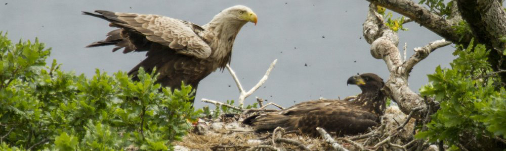
Black-throated diver
Rewilding
Shortly after returning from Lapland I learned that the organisation Rewilding Europe had identified the area as one of ten locations in Europe to benefit from a major rewilding initiative, aimed at preserving the natural and cultural heritage. You can read more about it by downloading the Rewilding Lapland brochure.


